
Assignment: Changing Landscapes Using Data Nesting
- Jan 23
- 4 min read
When talking about geographic data, it is hard for me to separate the aspects of a place from the aspects of the time in which it exists and the context in which the information about it will be used. Am I attempting to navigate to this place? Am I describing where it is relative to other places? Am I describing the land itself or the nations or peoples that claim it? For this assignment, I attempted to describe each coordinate as you may find it on Google Maps or Wikipedia and also add context such as Indigenous significance and descriptive labels.

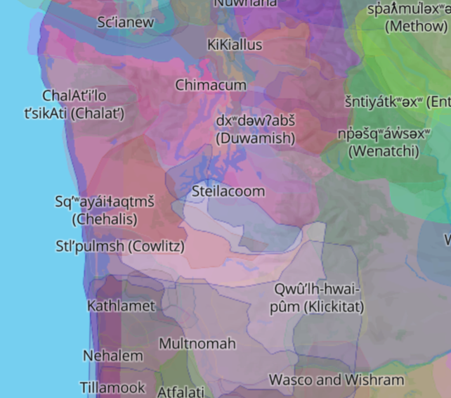
I decided to use the coordinate itself as the top level because it is both unique and descriptive. I used several sub-levels to help me understand and structure what I was finding as I looked up each data point. The level of “my_label” is intentionally “mine” because while it may describe what I understand, I didn’t want the information to seem definitive or authoritative. “Address” was originally my only place descriptor, but the inclusion of bodies of water had me add “Location” as well so that I could use nearby places to describe where the coordinates were pointing. Finally, “native land” describes the Indigenous peoples to whom the land is important according to the Native Land mapping tool.
In cases where there was conflicting information, I tried my best to include this information under the same descriptive label at the same level. For example, Arunachal Pradesh is currently claimed by both India and China, so I included both “addresses." I learned through Wikipedia that this border dispute is yet another artifact of British colonialism that has yet to be settled to this day. To make matters even less clear, China calls the region "Southern Tibet," suggesting a third label of Tibet that I did not include with my initial attempt.


Although I did not make many statements with data in this way, I believe that there is absolutely a place and time to use GIS data in a critical way. One example where I chose to go against Google Maps was with the Gulf of Mexico, which Google Maps now labels Gulf of America. It’s a small act to not adopt the name because I disagree with the people and policies that led to its change, and I agree with Pavlovskaya's conclusion in that small acts of GIS resistance can add up to bigger changes.
My full tree is below (click to expand):
.
├── 47°39'29.8"N 122°18'32.3"W/
│ ├── my_label/
│ │ └── University of Washington/
│ │ └── Denny Hall
│ ├── address/
│ │ └── United States/
│ │ └── Washington/
│ │ └── King County/
│ │ └── Seattle/
│ │ └── Klikitat Ln/
│ │ └── 98105
│ └── native land/
│ ├── Cowlitz
│ ├── Squaxin
│ ├── Nisqually
│ └── Cayuse, Umatilla and Walla Walla
├── 31°20'24.0"N 30°10'12.0"E/
│ ├── my_label/
│ │ └── Abu Kir Bay
│ ├── location/
│ │ └── Egypt/
│ │ └── Ikdu (off the coast of)
│ └── native land/
│ └── Amazigh
├── 25°54'11.2"N 88°51'47.0"W/
│ ├── my_label/
│ │ └── Gulf of Mexico
│ ├── location/
│ │ └── United States/
│ │ └── Louisiana/
│ │ └── Orleans Parish/
│ │ └── New Orleans (off the coast of)
│ └── native land/
│ ├── Houma
│ └── Chitimacha
├── 28°33'09.5"N 96°35'21.0"E/
│ ├── my_label/
│ │ └── Arunachal Pradesh
│ ├── address/
│ │ ├── India/
│ │ │ └── Arunachal Pradesh/
│ │ │ └── 791002
│ │ └── China/
│ │ └── Tibet Autonomous Region
│ └── native land/
│ └── unknown
├── 51°36'28.8"S 58°51'10.7"W/
│ ├── my_label/
│ │ └── Falkland Islands (Islas Malvinas)
│ ├── address/
│ │ └── United Kingdom/
│ │ └── British Overseas Territory/
│ │ └── FIQQ 1ZZ
│ ├── location/
│ │ └── Argentina/
│ │ └── Puerto Santa Cruz (off the coast of)
│ └── native land/
│ └── unknown
├── 44°54'19.5"N 147°32'07.3"E/
│ ├── my_label/
│ │ └── Kuril Islands
│ ├── address/
│ │ └── Russia/
│ │ └── Sakhalin Oblast/
│ │ └── Kuril Islands
│ └── native land/
│ ├── Ainu
│ ├── Nivkh
│ └── Orok
├── 18°25'16.2"N 66°42'59.5"W/
│ ├── my_label/
│ │ └── Puerto Rico
│ ├── address/
│ │ └── United States/
│ │ └── Puerto Rico
│ └── native land/
│ ├── Taino
│ └── Boriken Taino
├── 41°54'10.0"N 12°27'04.5"E/
│ ├── my_label/
│ │ └── Vatican City
│ ├── address/
│ │ └── Vatican City State/
│ │ └── Vatican City
│ └── native land/
│ └── unknown
├── 27°59'17.4"N 86°55'31.4"E/
│ ├── my_label/
│ │ └── Mount Everest
│ ├── address/
│ │ ├── China/
│ │ │ └── Tibet Autonomous Region/
│ │ │ └── Shigatse Prefecture
│ │ └── Tibet/
│ │ └── U-Tsang Region
│ └── native land/
│ └── unknown
└── 25°00'03.6"N 71°00'39.3"W/
├── my_label/
│ └── Bermuda Triangle
├── location/
│ └── North Atlantic/
│ ├── Florida
│ ├── Bermuda
│ └── Puerto Rico
└── native land/
└── unknown
Resources
Arunachal Pradesh. (2026). In Wikipedia. https://en.wikipedia.org/w/index.php?title=Arunachal_Pradesh&oldid=1339993281
Pavlovskaya, M. (2018). Critical GIS as a tool for social transformation. Canadian Geographies / Géographies Canadiennes, 62(1), 40–54. https://doi.org/10.1111/cag.12438
Comments